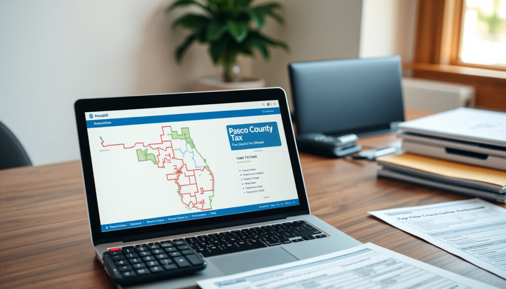
Pasco County Property Appraiser: Search, Maps & Tax Estimator
If you’ve ever tried to look up a property in Pasco County — for a home purchase, a tax question, or plain curiosity — you’ve met the same wall: lots of county websites, each pointing somewhere different. The good news is that the essential records sit in one place: the Pasco County Property Appraiser’s office led by Mike Wells, which lets you search by address, owner, or parcel ID.
Offices: 3 locations (Dade City, Land O’ Lakes, New Port Richey) ·
Main Phone: 727-847-8151 ·
Address: 8731 Citizen Dr. Suite 130, New Port Richey, FL 34654 ·
Email: media@pascopa.com ·
Website: pascopa.com
Quick snapshot
- The official records search supports parcel ID, owner name, address, recent sales, Official Record Book and Page, and map queries (Pasco County Property Appraiser Records Search).
- Property records include ownership, assessments, legal descriptions, and general property information (Pasco County Property Appraiser FAQs).
- Mike Wells is the elected Pasco County Property Appraiser (official website).
- Exact office staffing totals aren’t published in the office’s public records.
- Future millage rates will depend on county budget decisions, so next year’s estimate can change.
- Address results can lag new construction because addresses come from city and county Growth Management offices (Records Search).
- Florida’s state GIS portal collects parcel-level GIS files from all 67 county appraisers’ offices each April (Florida Department of Agriculture and Consumer Services GIS).
- The official downloads portal lists 2023 digital aerial photography (Pasco County Property Appraiser Downloads portal).
- Locate a property in the records search, then click Estimate Taxes at the top of the record (Pasco County Property Appraiser Estimate Taxes page).
- For bulk data, pull the countywide parcel shapefile or ESRI geodatabase from the downloads portal (Downloads). (Pasco County Property Appraiser Estimate Taxes page)
Five facts carry almost every Pasco County property question; here they are without the navigation.
| Detail | Value |
|---|---|
| Elected Official | Mike Wells |
| Office Locations | Dade City, Land O’ Lakes, New Port Richey |
| Main Phone | 727-847-8151 |
| Address | 8731 Citizen Dr. Suite 130, New Port Richey, FL 34654 |
| media@pascopa.com | |
| Website | pascopa.com |
| Hours | Monday – Friday, 8:30 AM – 5:00 PM |
The pattern: the table above consolidates the office contact details — everything else runs through the online tools.
How to Search for Pasco County Properties
Every parcel record in Pasco County flows through the appraiser’s online search at search.pascopa.com. The tool accepts parcel ID, owner name, physical address, recent sales, Official Record Book and Page, and interactive map queries — so the right entry point depends on what you already have.
Using the Official Website
- Parcel ID search — fastest when you have the county’s parcel number.
- Owner name search — returns every property under a person’s or company’s name.
- Address search — matches against street name and number, using county addressing records.
- Recent sales and Official Record Book/Page — for deed-level and transaction research.
If you don’t know the parcel ID, the owner name and address routes are the practical alternatives. The system doesn’t force you into one schema, which makes the first search easier than most county databases.
Searching by Parcel ID
- A parcel ID is the county’s permanent identifier for a piece of land.
- Entering it returns the full parcel record: ownership, assessments, legal description, and building data.
- The same record is reachable by clicking the parcel on the interactive map.
The pattern: no single search route is the “right” one. Parcel IDs give the cleanest results, but owner and address searches work when you’re starting with a name or a street.
How to Search by Owner, Address, or Name
The same portal handles all three textual lookups. Owner-name search is the quiet workhorse: type a name, and the county returns every parcel associated with it.
Search by Owner
- Owner search returns all properties under that name in one result set (Pasco County Property Appraiser FAQs).
- Use it for individuals, trusts, LLCs, or any legal entity that owns real estate in Pasco County.
Search by Address
- Address search needs a street name and number; the system searches across the county’s official addressing records (Pasco County Property Appraiser Records Search).
- If a new home doesn’t appear, the address may not be in the city or county Growth Management database yet.
Search by Name
- Name search is case-insensitive and supports partial matches, so you can start with just a last name (Records Search).
- Open any result to view the full parcel record and confirm the owner, address, and assessed value.
Addresses in the appraiser’s system come from City and County Growth Management offices, according to the official records search. A brand-new home can be missing from an address lookup until the local address record catches up — and the parcel ID route won’t leave you guessing.
What this means: if an address search comes up empty, don’t assume the property is unrecorded. Find it by parcel ID or owner name instead.
How to Use the Pasco County Property Appraiser Map and GIS
The map is the visual layer over the records database. You can pull up a street or intersection, then inspect each parcel boundary, ownership record, and assessed value from the same frame.
Accessing the Interactive Map
- The map-search option can display a map for a particular street or intersection, according to the official FAQ (Pasco County Property Appraiser FAQs).
- Clicking a parcel on the map opens the same record you’d get from a text search: owner, value, legal description, and tax estimate link.
- The map feeds from the official parcel layer, so the geometry lines up with the appraiser’s valuation records.
Using GIS Layers
- The official downloads portal publishes a countywide parcel shapefile with parcel-summary attribution (Pasco County Property Appraiser Downloads portal).
- It also lists an ESRI file geodatabase with appraisal and spatial data, a Department of Revenue shapefile library, and section maps in PDF.
- Current releases include 2023 digital aerial photography and Department of Revenue tax-roll data files.
The map is not just a viewer. Behind it sits a downloadable GIS dataset — shapefile, geodatabase, section maps, and tax-roll data — that lets anyone analyze Pasco property data offline instead of clicking parcel by parcel.
A step beyond the county: Florida’s state GIS portal, run by the Florida Department of Agriculture and Consumer Services, collects parcel-level GIS files from all 67 county property appraisers’ offices each April (Florida Department of Agriculture and Consumer Services GIS).
The implication: the GIS layer is public infrastructure. If you need boundaries, area, or adjacency, the map is faster than any text query — and the downloads make the data portable when the map isn’t enough.
How to Use the Pasco County Property Appraiser Tax Estimator
The tax estimator is the tool people remember after their first property search. It’s also the easiest to misuse, because it doesn’t live on a standalone page.
Estimating Taxes for a Specific Property
- Start in the records search and locate the property by address, parcel ID, or owner name.
- Click Estimate Taxes at the top of the parcel record (official Estimate Taxes page).
- The estimate uses the property’s assessed value together with current millage rates for the relevant tax districts.
Understanding Millage Rates
- Millage rates are set by the taxing authorities — county, city, school district, and special districts — and feed the estimator alongside the assessed value.
- The official tool is explicit that the result is an estimate for informational purposes, not a final bill.
Use the estimator to compare properties, not to file anything. The number shifts when exemptions attach to the parcel or a new millage rate is adopted, so treat every result as a snapshot, not a promise.
The practical difference: a buyer can run the estimator on three houses and compare annual costs in minutes. The same workflow tells a current owner whether their assessed value — and therefore their projected tax — is moving in line with the county’s records.
Why this matters: the estimator answers the question buyers actually ask — what will this property cost me per year — but only if you reach it through the parcel record, where the assessed value is current.
Who is Mike Wells, the Pasco County Property Appraiser?
Mike Wells is the elected Property Appraiser for Pasco County. The office he leads maintains the valuation and records system that the search, map, and estimator depend on.
Role and Responsibilities
- Wells is the elected official listed on the county appraiser’s website (Pasco County Property Appraiser official website).
- His office oversees property assessments, exemption records, the public records search, and the GIS and downloads portal.
- The office’s stated commitment, in Wells’ own description, is “exceptional service, fairness and accuracy.”
Contact Information
- Main phone: 727-847-8151
- Email: media@pascopa.com
- New Port Richey office: 8731 Citizen Dr. Suite 130, New Port Richey, FL 34654
- Hours: Monday – Friday, 8:30 AM – 5:00 PM
The office’s phone, email, locations, and hours are all published on the official site (official website).
What this means: the appraiser’s office is a public-records operation first. The phone number and email matter, but most answers live in the search and map tools you can use without waiting on hold.
How to Look Up a Property in Pasco County, Step by Step
The full workflow condenses into a routine that takes about five minutes the first time you walk through it.
- Go to search.pascopa.com — the official records search portal.
- Choose your search type: parcel ID, owner name, address, recent sales, or Official Record Book and Page.
- Enter the value and review the matching parcels.
- Open the record to see ownership, assessed value, legal description, and building details.
- Click Estimate Taxes at the top of the record to pull the annual estimate (Estimate Taxes page).
- Use the map option on the same record to view the parcel boundary and surrounding properties.
- For GIS data or bulk analysis, go to downloads.pascopa.com.
The payoff: this routine gets you from a bare address to a defensible tax estimate in under ten clicks. The only point that requires a human is the judgment call about what the value means for your budget.
Confirmed Facts vs. What’s Still Unclear
Here’s the split between what the official sources pin down and what they leave open.
- The records search supports parcel ID, owner, address, recent sales, Official Record Book and Page, and map queries (Records Search).
- Property records include ownership, assessments, legal descriptions, and general property information (official FAQ).
- Tax estimates are reached from the parcel record via the Estimate Taxes link (Estimate Taxes page).
- Downloads include a parcel shapefile, ESRI geodatabase, 2023 aerial photos, section maps, and Department of Revenue tax-roll data (Downloads portal).
- Exact staffing levels at the appraiser’s office aren’t disclosed in its public pages.
- Future millage rates will be set through county budget decisions, so later estimates can shift.
- Address completeness for new construction depends on City and County Growth Management address records (Records Search).
- The tax estimator is informational only; the final bill depends on exemptions and the separate Tax Collector process.
Reading those two lists together gives you the working rule: trust the official tools for what they’re built for, and verify anything time-sensitive with the office directly.
What the Official Sources Say
Our office is committed to exceptional service, fairness and accuracy.
Mike Wells, Pasco County Property Appraiser (official website)
Visit the records search, locate the property, and click Estimate Taxes at the top of the record.
Pasco County Property Appraiser Estimate Taxes page
Parcel-level GIS files are collected from all 67 county property appraisers’ offices each April.
Florida Department of Agriculture and Consumer Services GIS
The pattern: every official source points back to the same workflow — search first, estimate second, and call the office only when the record doesn’t answer the question.
The Takeaway for Pasco County Homeowners and Buyers
Most Pasco County property questions don’t require a phone call. The records search, tax estimator, and GIS map answer the three questions behind nearly every property decision — what the property is, what it’s worth, and what it will cost to own. For buyers, the routine is clear: run the estimate before making an offer, then pull the parcel map to see what you’re actually buying. For current owners, the same tools show whether your assessed value lines up with the county’s data. For Pasco County property owners, the choice is clear: pull your own parcel record before the next assessment cycle, or keep relying on someone else’s spreadsheet.
Related reading
- Net Worth: What It Is and How to Calculate It
- Hot Water Heater Replacement Near Me: Cost & Lifespan Guide
pascopa.com, pascopa.com, pascocountypropertyappraiser.org, property-appraisers.org
Frequently asked questions
What is the role of the Pasco County Property Appraiser?
The Property Appraiser’s office determines property values for tax purposes, maintains public property records, and publishes appraisal and GIS data. Mike Wells is the elected appraiser who leads the office, and the records search is its public entry point for ownership, assessment, and tax-estimate information.
Are property records public in Florida?
Yes. Pasco County’s property records are publicly accessible through the official records search at search.pascopa.com. Anyone can look up ownership, assessed value, legal descriptions, and parcel boundaries without an account.
How often are property values reassessed in Pasco County?
Pasco County follows the state’s annual cycle. Florida’s state GIS portal notes that parcel-level GIS files are collected from all 67 county property appraisers’ offices each April, so the county’s parcel data is refreshed on that yearly schedule.
Can I appeal my property assessment?
Assessments are maintained by the Property Appraiser’s office, and an appeal starts there. Use the phone number or email on the official site to ask about the process for your specific parcel.
What is the difference between the Property Appraiser and Tax Collector?
The Property Appraiser determines values, maintains records, and provides tax estimates. The Tax Collector is the separate office responsible for tax collection. The appraiser’s records search includes a link to Tax Collector information, so you can move from the assessed value to the billing side from one starting point.
How do I apply for a homestead exemption?
Exemptions are part of the Property Appraiser’s responsibilities, and the office’s exemptions section on pascopa.com is where the tax-estimate and exemption resources live. The parcel record in the official records search shows which exemptions are already applied.
What is a parcel ID and how do I find it?
A parcel ID is the county’s unique identifier for a piece of land, used in assessments, deeds, and tax records. Find it by looking up any address or owner in the official records search — the ID appears on the parcel record and on the interactive map.
More related posts
 Cal Raleigh Home Runs: 60 in 2025 Season
 Oregon vs James Madison 2025 CFP: Final Score, Highlights, and Analysis
 What Is 6-7 Slang? Meaning, Origin, and Hand Gesture Explained
 Things to Do in Nashville: Must-Sees & Itineraries
 Italian Ice Near Me: Healthier than Ice Cream
 Adria Arjona Movies and TV Shows – Complete Filmography 2024
 Is GTA 5 Crossplay? Complete Guide for PC, PlayStation, Xbox
 Michael Stuhlbarg Movies and TV Shows: Full Filmography
